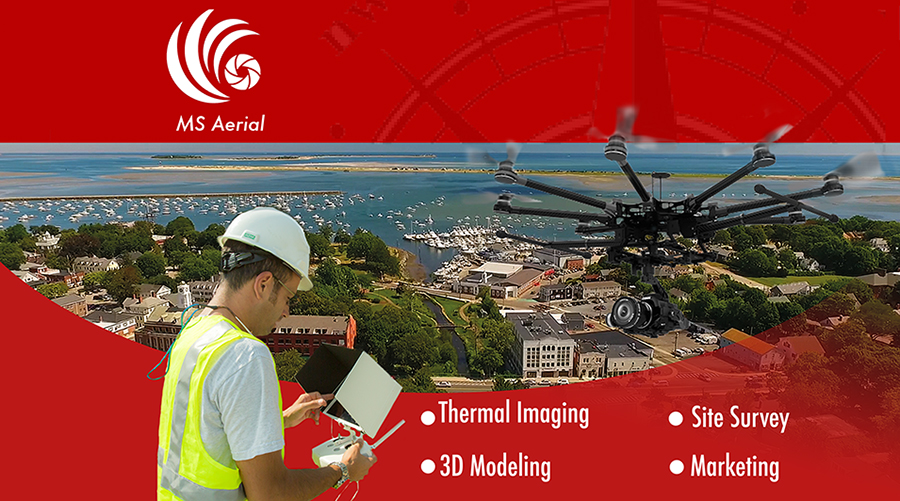
Explore our services
The need for aerial documentation continues to grow and expand. We have the ability to bring value to your project help aid in bridging the gap between concept and achieving a vision. We have worked with local government, marketing agencies, factories and large scale construction companies. Let us help you find your perfect vision.
Services
.
Facade
Our team is often invited onto a facade review during the bidding process. We aid architects, engineers, and building owners to find the best solution to access and review their building facade. Clients find that cutting out costly swing staging and replacing the large footprint of a boom truck can be an obvious choice. Should a building envelope not be able to be reviewed by binoculars, our aerial services may be a great option. For buildings, six stories and under are orthomosaic photogrammetry panoramas are a perfect solution that will help clients annotate and georeference your report.
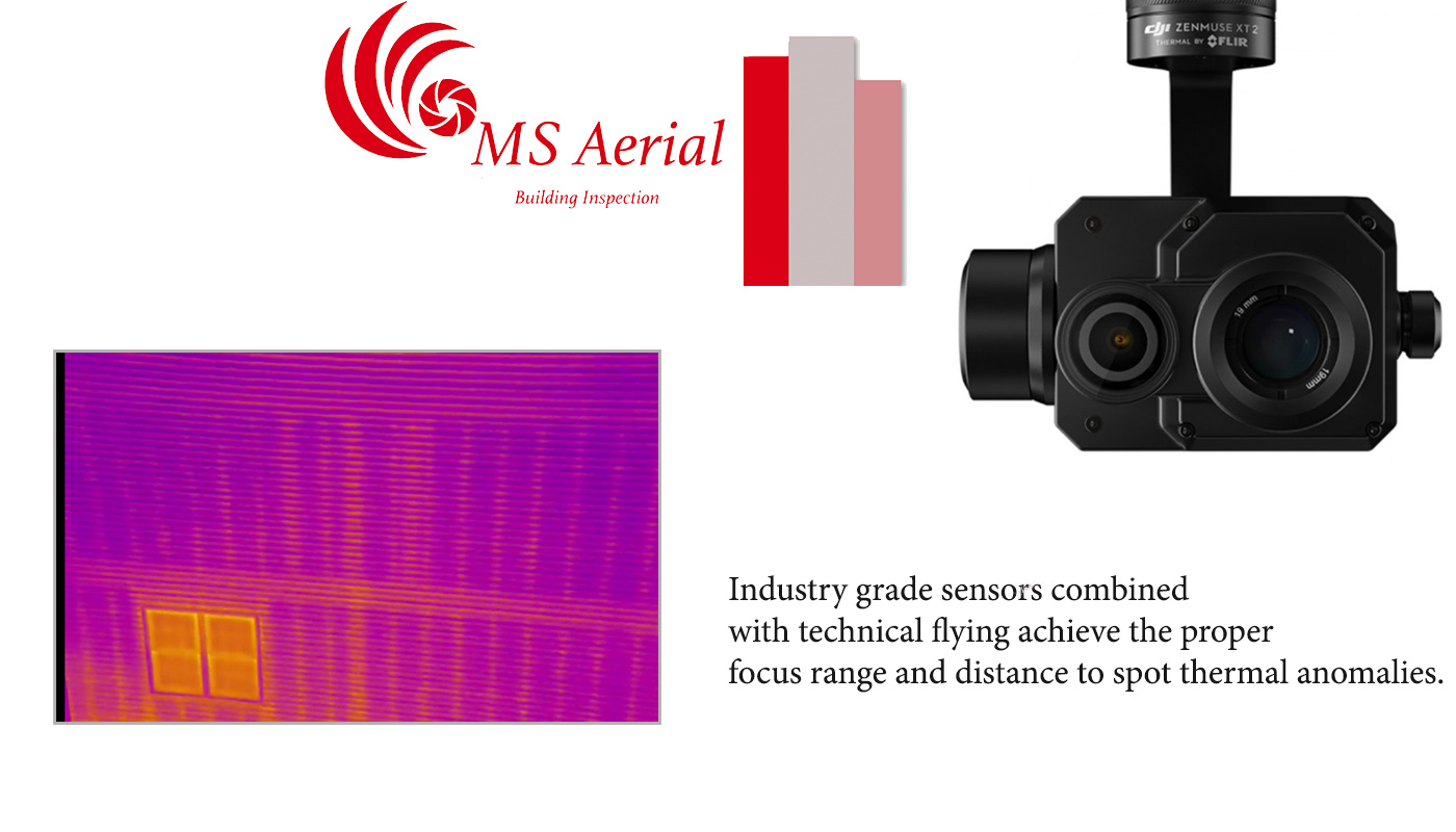
Infrared
Multi Spectral Aerial Solutions proudly announces our embarkation. Into energy conservation. In addition to home energy audits, infrared technology Can be used to detect energy loss in building envelopes and roofs. MS Aerial is a vital defense tool in the ever-changing and sometimes violent New England weather. We can incorporate site overlays and graphics to any existing conditions, property overviews, surrounding roads, hazards. You (the client) do not have to be on site. during shooting, However we definitely extend an invitation to see this amazing technology in action
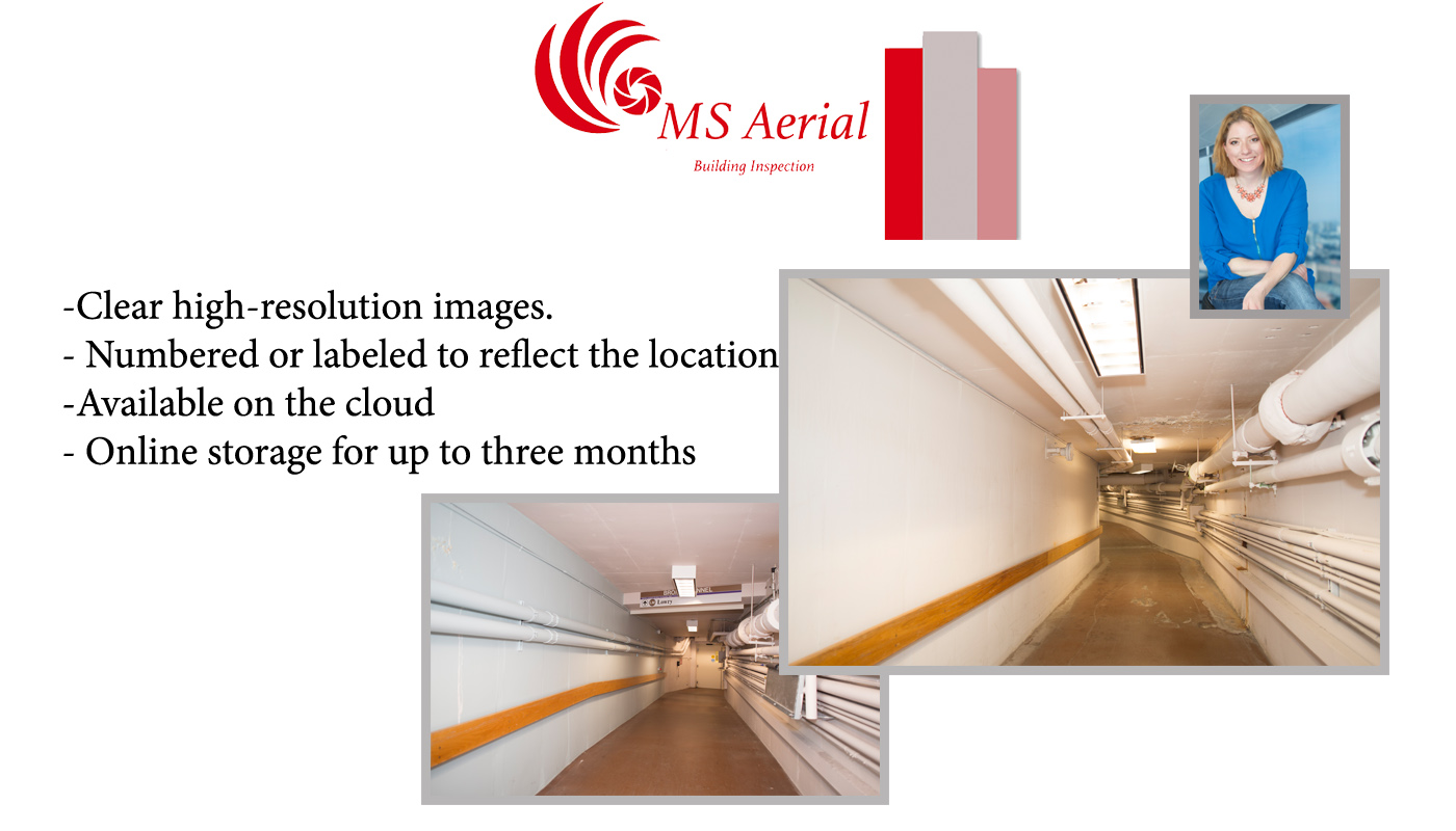
Interior existing conditions
The documentation of pre-existing conditions in building interiors is an important piece of the construction process. Along with clear, well-lit photographs we aim to preserve the historical integrity of the interior through imagery before any surrounding building modification takes place.
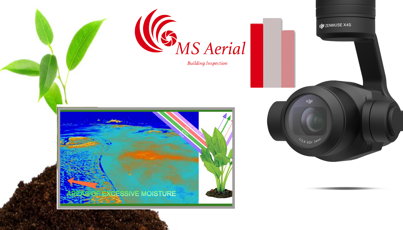
NDVI
NDVI ( Normalized Difference Vegetation Index) is a graphical representation of the health of vegetation. Imagery taken by MS Aerial has an excellent spatial resolution of 1 Centimeter. Our aerial cameras allow for more detail-oriented images along with the ability to find trouble areas within an area of Study needing attention. Since NDVI incorporates the near-infrared wavelengths, we provide information that is unseeable To the human eye. NDVI incorporates the plant structure along with chlorophyll content to measure the vegetation health in a way not possible from a simple aerial Image. MS Aerial staff includes an experienced professional with several years’ experience incorporating NDVI Vegetation monitoring serviced by Multi Spectral Aerial Solutions is available for many clients including City and Town Parks Department, Agriculture,and Sports Turf Maintenance such as golf courses. Golf Course maintenance includes several techniques for proper vegetation growth such as fertilizers, aerification, mowing, and efficient watering cycles. A superintendent can experience many issues throughout a golf course per season relating to unhealthy grass leading to death if not dealt with properly. In general these issues are spotted by the crew simply by noticing with their eyes and it is too late. NDVI imagery is an efficient monitoring technique to pin point these areas of unhealthy vegetation before they become a serious issue. A detailed report serviced by MS Aerial will allow the Golf Course Superintendent to plan the proper maintenance techniques for these problem areas. Furthermore, the NDVI Expert at MS Aerial has 10 years of golf course maintenance experience to work closely with every client.
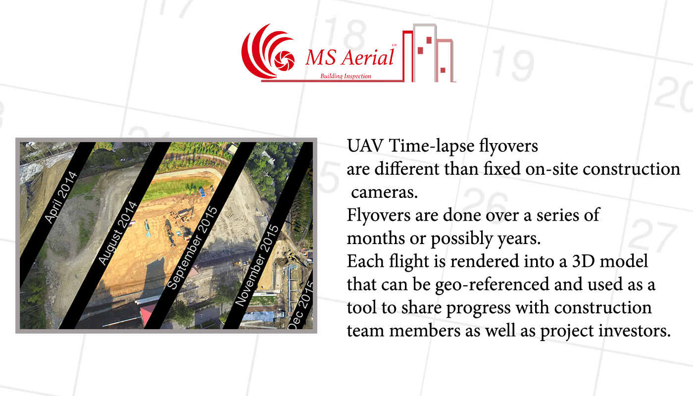
Long Term Project Coverage
Time-lapse photography is one of the many exciting possibilities of Unmanned aerial vehicles. Our specific procedure is perfect for large scale construction projects. Or for highlighting environmental change within a community or landscape. The typical process we recommend is 8-10 Visits over ten months. We will collect footage and make you a spectacular visual representation of time lapseTime-lapse documentation is one of the many exciting possibilities of our Unmanned aerial vehicles. Our specific procedure is perfect for large scale construction projects. Or for highlighting environmental change within a community or landscape. The typical process we recommend is 8-10 Visits over ten months. We will collect footage and make you a spectacular visual representation of time lapse
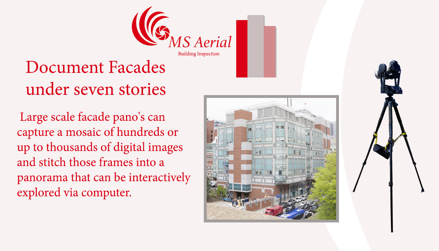
High-resolution panoramas
Our team uses specialized equipment that aids in facade inspection for buildings under seven stories. Images of building elevations are stitched using hundred of images to create a highly detailed capture. The unique apparatus is used at ground level and is a useful tool for low buildings where archiving is necessary.
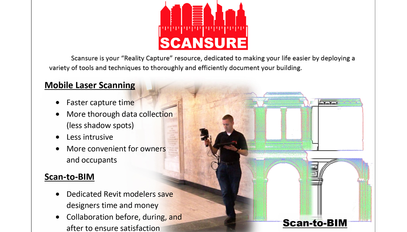
Interior Mapping
Multi Spectral Aerial Solutions has partnered with Scansure to find the perfect complement to aerial mapping. Doug Magners, an expert in his field has a solid deliverable that is an easy answer for architects and engineers
Please reach out via the contact information provided and we will promptly supply you with a quote and timeframe for project completion.